Size of this preview: 450 × 600 pixels. Other resolutions: 180 × 240 pixels | 480 × 640 pixels.
Original file (480 × 640 pixels, file size: 342 KB, MIME type: image/jpeg)
Test
Summary
| Description |
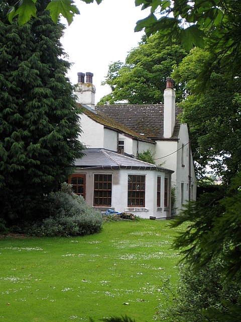
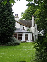
English: Carlton Hall Farmhouse. This grade II listed farmhouse in Queen Street dates back to the 16th century, but has had many alterations over time. The house is timber framed, with a later cladding of stone, now all rendered, and a slate roof. Internally there is an original moulded plaster ceiling with the arms of Elizabeth I, flanked by the initials "E R" and surrounded by lettering: "HONI : SOIT : QUI : MAL : Y : PENSE".
Originally Carlton Hall was the seat of the Hunt family and Thurstan Hunt was born here in 1555. See1316262 |
| Date | |
| Source | From geograph.org.uk |
| Author | Mike Kirby |
| Attribution (required by the license) | Mike Kirby / Carlton Hall Farmhouse / |
| Camera location | | View this and other nearby images on: OpenStreetMap |
|---|
| Object location | | View this and other nearby images on: OpenStreetMap |
|---|
Licensing

|
This image was taken from the Geograph project collection. See this photograph's page on the Geograph website for the photographer's contact details. The copyright on this image is owned by Mike Kirby and is licensed for reuse under the Creative Commons Attribution-ShareAlike 2.0 license.
|
This file is licensed under the Creative Commons Attribution-Share Alike 2.0 Generic license.
Attribution: Mike Kirby
- You are free:
- to share – to copy, distribute and transmit the work
- to remix – to adapt the work
- Under the following conditions:
- attribution – You must give appropriate credit, provide a link to the license, and indicate if changes were made. You may do so in any reasonable manner, but not in any way that suggests the licensor endorses you or your use.
- share alike – If you remix, transform, or build upon the material, you must distribute your contributions under the same or compatible license as the original.
File history
Click on a date/time to view the file as it appeared at that time.
| Date/Time | Thumbnail | Dimensions | User | Comment | |
|---|---|---|---|---|---|
| current | 17:19, 27 February 2011 | | 480 × 640 (342 KB) | wikimediacommons>GeographBot | == {{int:filedesc}} == {{Information |description={{en|1=Carlton Hall Farmhouse This grade II listed farmhouse in Queen Street dates back to the 16th century, but has had many alterations over time. The house is timber framed, with a later cladding of sto |
File usage
The following 3 pages use this file:

_heading:225.00&language=en)
_heading:225.00&language=en)